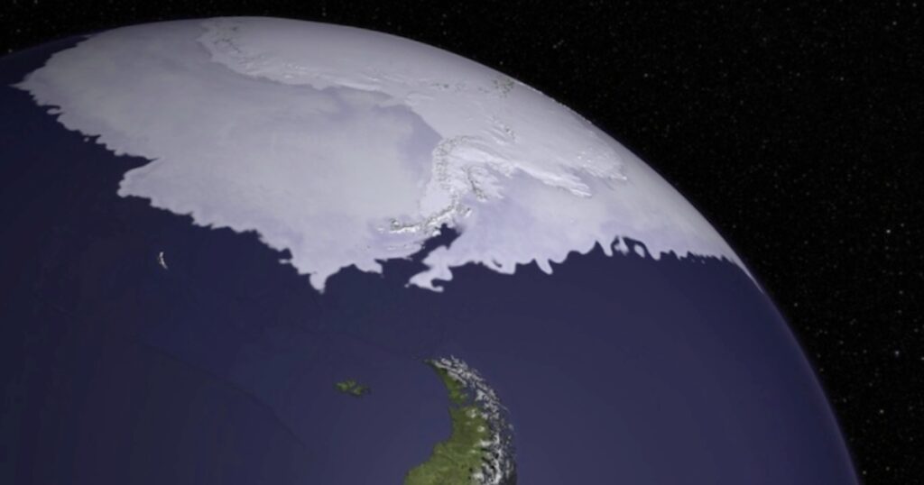
Viewing Antarctica from Space is fascinating. The southernmost continent on Earth, Antarctica, possesses a captivating charm due to its distinct environment and frigid vistas. We can now view this distant region of the earth from orbit, thanks to developments in satellite technology.
These satellite photos of Antarctica show the dynamic character of this polar region, from melting ice shelves to active volcanoes, and offer important insights into the changes taking place on the continent.

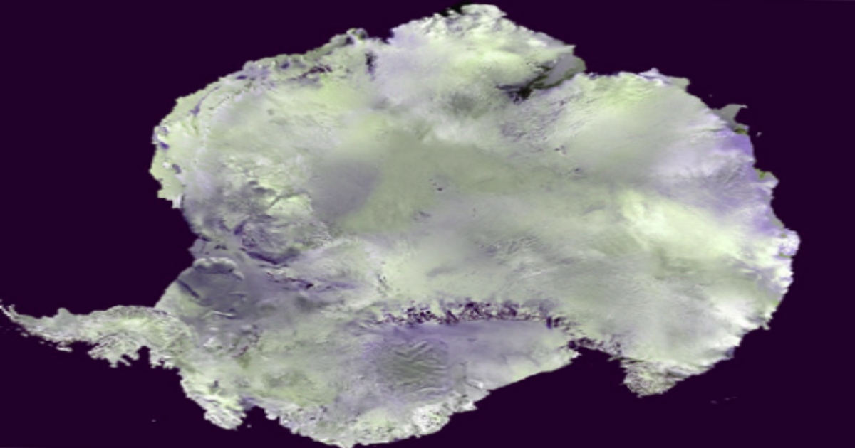
We can see breathtaking Views of Antarctica from Space Thanks to Satellites.
Seeing Antarctica from space gives us a unique and humble aspect of its size and splendor. These photos help us to fully comprehend the scope and magnificence of this glacial landscape, from vast white plains and angular ice shelves to the magnificent glaciers that loom endlessly.
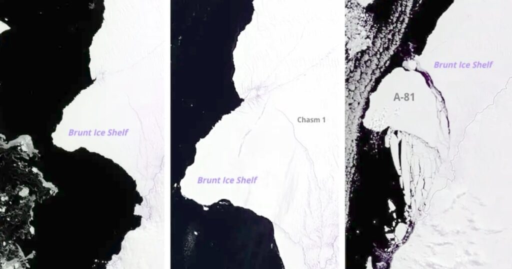
Brunt Ice Shelf Antarctica: Iceberg A-81 Antarctica
NASA Earth Observatory noted expanding fissures in the Brunt Ice Shelf in Antarctica in 2019. The iceberg, which is thought to be twice the size of New York City, was still there two years later. The last break occurred on January 22, 2023.
The iceberg, known as A-81, is seen in these three photos as it moves from crack to calving.
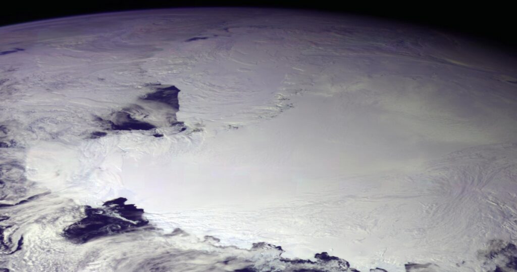
Ross Ice Shelf Antarctica:
The greatest ice shelf in Antarctica is the Ross Ice Shelf. Its thickness is several hundred meters. The virtually vertical ice front that leads to the open sea is between 15 and 50 meters above the water’s surface, and it spans more than 600 kilometers. On the other hand, 90% of the floating ice is submerged in the sea.
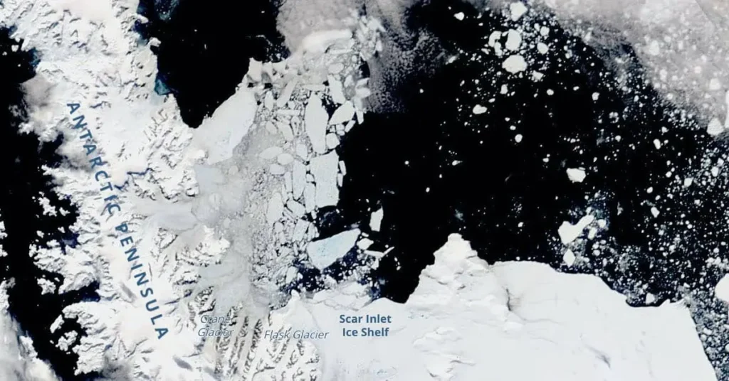
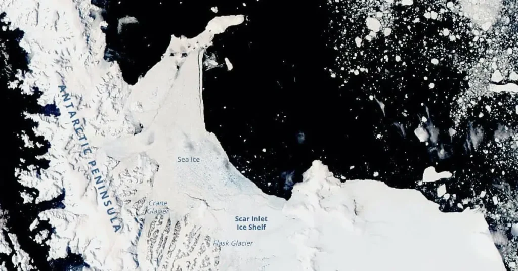
Larsen B Embayment Antarctica:
The Smithsonian claims that every winter, the seas surrounding Antarctica freeze, forming a thick coating of ice that gives the continent the appearance of being twice as large. This ice fractures into floating chunks known as pack ice in the summer.
The Larsen B Embayment may be seen in the two photos below, which were captured by the NASA Earth Observatory on January 16 and 26, 2022, changing from entire to broken in a few short days.
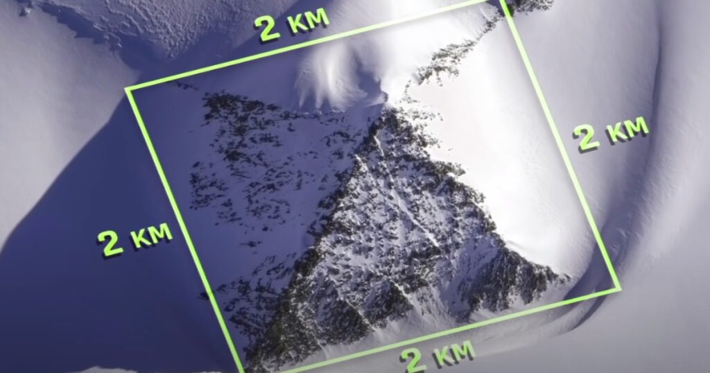
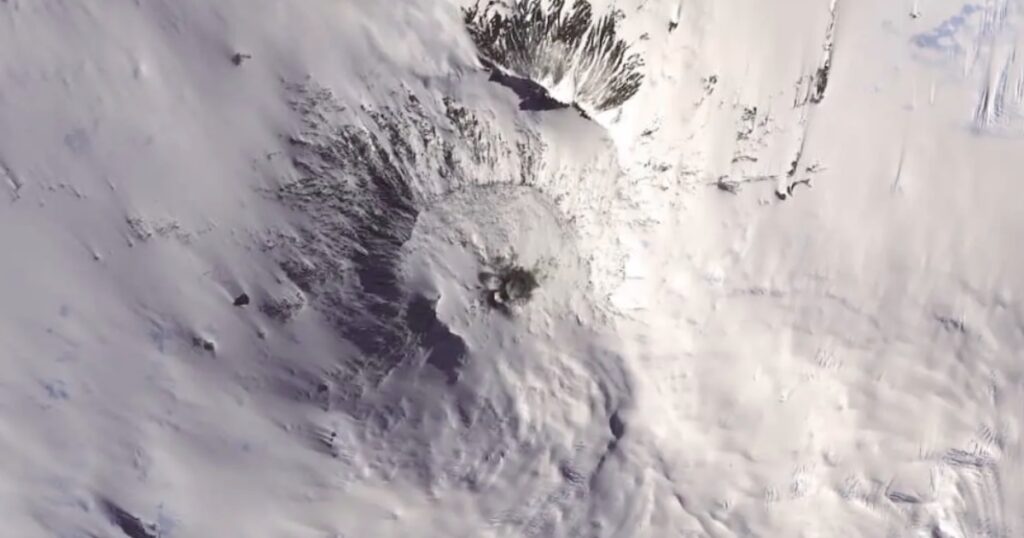
Is there a Pyramid in the Mountain Range in Antarctica?
The Internet was overrun with rumors in 2016 about a freshly found pyramid in Antarctica, of all places. It was eventually shown by CBS News, nevertheless, to be “just a mountain that looked like a pyramid.” The pyramid-shaped peak in Antarctica’s Heritage Peak Range is shown in dramatic detail in the video below.
Are there Active Volcanos in Antarctica?
Mount Erebus Volcano Antarctica:
Volcano Erebus, one of only two active volcanoes in Antarctica, is located near the South Pole on Ross Island and is the southernmost active volcano on Earth, according to PBS. In this case, looking at it from orbit seems to lessen its impact. Nonetheless, it’s an intriguing viewpoint.
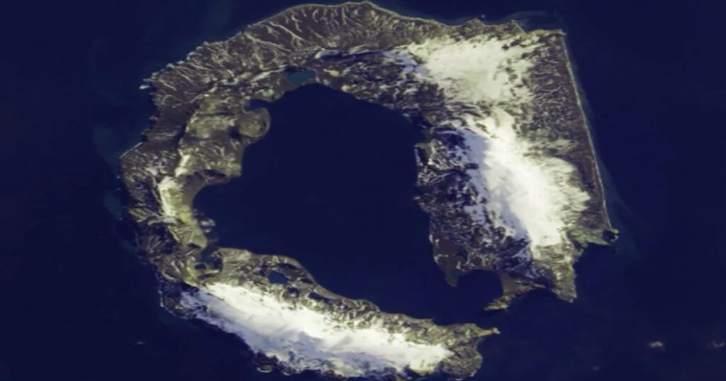
Deception Island Volcano Antarctica:
One of the South Shetland Islands, Deception Island is located in the Drake Passage, off the coast of the Antarctic Peninsula. It is a submerged volcano whose about 10-mile (16-kilometer)-diameter crater serves as one of the best Antarctic anchorages.
Since 1910, the harbor also referred to as Port Foster has served as the main point of entry for British claims in the Antarctic.
The island was also used as a British military facility during World War II and as a whaling and seal-hunting station from 1906 to 1931. The island is claimed by Argentina, Chile, and the United Kingdom, all of which maintain stations there. The island experienced earthquakes and volcanic eruptions starting in 1967.
What can be learned from satellite observations of Antarctica?
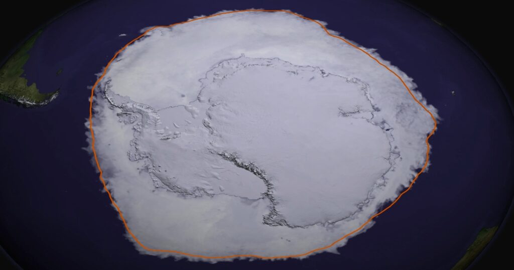
We may discover Antarctica’s mysteries and marvel at its beauty thanks to the Landsat Image Mosaic of Antarctica (LIMA), which offers a distinctive viewpoint on the continent. There’s also a lot to figure out.
Antarctic vs. Arctic Image:
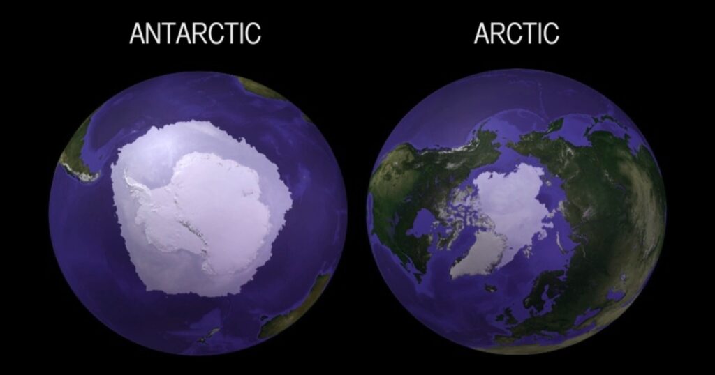
We may learn a great deal about weather patterns, scientific research, environmental health, and the collapse of the climate by looking at this frozen continent from space.
Understanding the effects of the climate crisis on Antarctica is made easier by tracking changes in sea ice, ice shelves, and glaciers from space. Monitoring the pace of glacier melt, increasing sea levels, and the impact on patterns of the global climate are all part of this.
Researchers may also keep an eye on wildlife numbers, plant distribution, and environmental issues like pollution and human influence by using satellite imagery to track the health of Antarctica’s ecosystems.
More accurate weather forecasting models are a result of accurate measurements of Antarctic wind patterns, cloud cover, and atmospheric conditions. Lastly, arranging scientific investigations and trips, determining accessibility, and helping researchers choose study sites are all aided by satellite imagery of Antarctica.
Antarctica – Overview
The southernmost and least populous continent on Earth is Antarctica. The geographic South Pole is located there. It is nearly completely south of the Antarctic Circle and is encircled by the Southern Ocean, often referred to as the Antarctic Ocean.
With a land area of 14,200,000 km^, roughly 40% more than that of Europe. Antarctica is the sixth biggest continent (5,500,000 sq mi). The Antarctic ice sheet, which has an average thickness of 1.9 km (1.2 mi), covers the majority of Antarctica.
Antarctica has the greatest average elevation among the continents and is generally the coldest, driest, and windiest. With yearly precipitation of around 200 mm (8 in) at the shore and much less inland, it is mostly a polar desert.
The world’s freshwater reserves, which are mostly frozen in Antarctica, could boost global sea levels by over 60 meters (200 feet) if they melted. At -89.2 °C (128.6 °F), Antarctica has the lowest recorded temperature on Earth.
In the summer, temperatures along the seaside can get beyond 10 °C (50 °F). Animals that are native to the area include tardigrades, nematodes, penguins, seals, and mites. When there is vegetation, it often appears as lichen or moss.
Conclusion:
If the remarkable vistas and scientific findings of Antarctica captivate you, it’s worthwhile to learn more about the topic. To discover more about the wonders of this far-off continent and its vital role in our planet, check out the materials offered by agencies such as NASA and the British Antarctic Survey.